

America’s Next Indoor Snow Centre Takes Shape
Construction of a new indoor snow centre for skiers, boarders and tubers appears to be making good progress at Heritage Farm in Wayne County, West Virginia.

Next 4 days weather summary:chuva mod. (total 15.0mm), mais intensa na Terça à tarde. Muito ameno (máx. 17°C na Quarta à tarde, mín 7°C na Terça à noite). o vento será geralmente fraco. | Dias 5-7 Igls Resumo do Tempochuva mod. (total 18.0mm), mais intensa no Domingo à tarde. quente (máx. 22°C no Sábado à tarde, mín 7°C na Qui à noite). o vento será geralmente fraco. | |||||||||||||||
Terça 21 | Quarta 22 | Quinta 23 | Sexta 24 | Sábado 25 | ||||||||||||
noite | manhã | tarde | noite | manhã | tarde | noite | manhã | tarde | noite | manhã | tarde | noite | manhã | tarde | noite | |
aguaceiros | Risco Trovoada | Risco Trovoada | aguaceiros | céu limpo | céu limpo | parcial/ nublado | aguaceiros | chuva fraca | aguaceiros | céu limpo | céu limpo | parcial/ nublado | céu limpo | céu limpo | chuva fraca | |
km/h | ||||||||||||||||
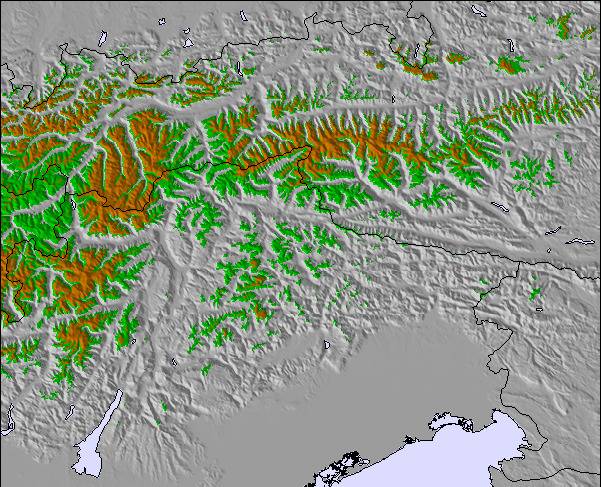
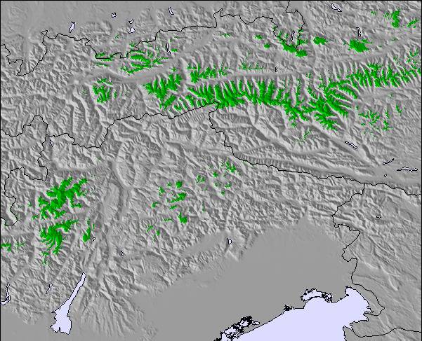
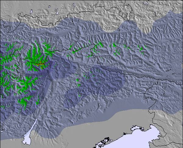
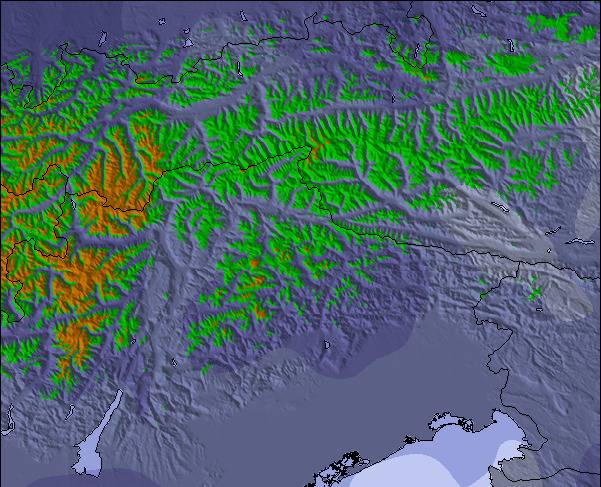
Mapa de neve |  |  |  |  |  |  | ||||||||||
— | — | — | — | — | — | — | — | — | — | — | — | — | — | — | — | |
mm | 1 | 1 | 4 | 4 | — | — | — | 1 | 4 | 4 | — | — | — | — | — | 3 |
max °C | 13 | 13 | 13 | 11 | 12 | 17 | 14 | 11 | 13 | 10 | 12 | 17 | 15 | 18 | 22 | 19 |
min °C | 9 | 9 | 13 | 7 | 7 | 15 | 9 | 9 | 13 | 7 | 7 | 16 | 11 | 12 | 21 | 11 |
chill °C | 9 | 9 | 12 | 7 | 7 | 15 | 9 | 9 | 12 | 7 | 7 | 16 | 11 | 12 | 21 | 10 |
Humid. % | 82 | 68 | 67 | 81 | 55 | 35 | 61 | 65 | 52 | 73 | 48 | 29 | 57 | 39 | 30 | 83 |
Nível de congel. m | 3550 | 3350 | 3200 | 2800 | 3150 | 3400 | 3100 | 3000 | 3000 | 2750 | 3300 | 3550 | 3800 | 3800 | 4150 | 3700 |
— | 5:39 | — | — | 5:39 | — | — | 5:41 | — | — | 5:41 | — | — | 5:43 | — | — | |
— | — | — | 9:00 | — | — | 9:00 | — | — | 8:59 | — | — | 8:58 | — | — | 8:57 | |
Vire pro e carve em:
Informações de avalanche: European Avalanche Warning Services (EAWS)
Últimos relatórios de neve perto de Igls:
| Profundidade da neve no topo | — |
|---|---|
| Profundidade da neve mais baixa | — |
| Profundidade da queda de neve fresca | — |
| Quando foi a última vez que nevou? | 18 May 2026 |
0.0 | Dias de sol com neve pó Neve fresca, principalmente ensolarado, vento fraco. |
|---|---|
0.0 | Dias de neve pó Neve fresca, sol limitado, qualquer vento. |
0.0 | dias de sol Neve média, na maioria das vezes ensolarado, vento fraco. |
As tabelas acima dão a previsão do tempo para Igls à altitude específica de 1558 m. Nossos sofisticados modelos de tempo permitem-nos obter a previsão de neve para estações no topo, na parte média e na baixa de Igls. Para acessar a previsão do tempo para outras elevações, utilize o botão tab acima da tabela. Para uma visão mais ampla do tempo, dê uma olhada em Weather Map" of Austria.
Click here para ler mais informações sobre os níveis de congelamento e de como nós prevemos nossas temperaturas.
Geral 3.7 baseado em 2 Votos e 2 avaliações
Great couple of days here - during a warm blip though - snow was considerably better in Stubai and Axamer. However, the views over Innsbruck, down the valley to Stubai and beyond were a total knockout. Good mixture of runs and good restaurants. The olympic red is long and fairly mental - loved it. Lifts are in need of an upgrade but for a morning or afternoon blast it doesn't matter. Skiing around Innsbruck has opened my eyes!! Goodbye France!!
matt de United Kingdom escreve:
Great couple of days here - during a warm blip though - snow was considerably better in Stubai and Axamer. However, the views over Innsbruck, down the valley to Stubai and beyond were a total knockout. Good mixture of runs and good restaurants. The olympic red is long and fairly mental - loved it. Lifts are in need of an upgrade but for a morning or afternoon blast it doesn't matter. Skiing around Innsbruck has opened my eyes!! Goodbye France!!

 Nearest