
Guia da estância de esqui Ruwenzori
Estado das Pistas
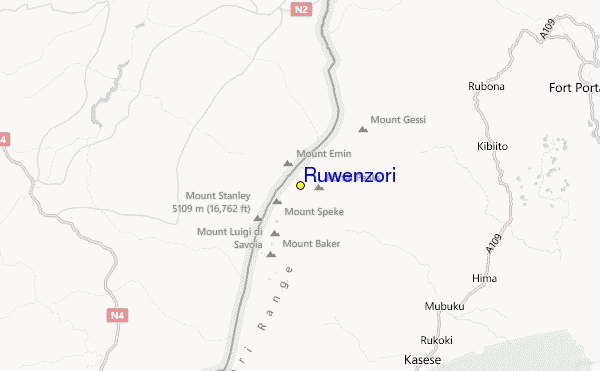
5109m
2743m
2366m
- Acres de esqui:-
- Pistas:-
- Máquina de neve:-
- Halfpipes:-
- Terrain Parks:-
- X-Country:-
- Iniciante-
- Intermediário-
- Avançado-

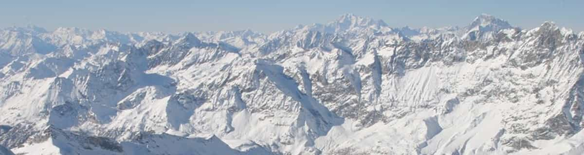
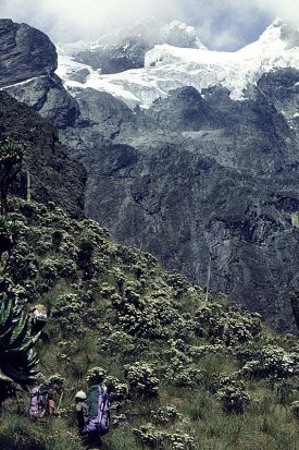
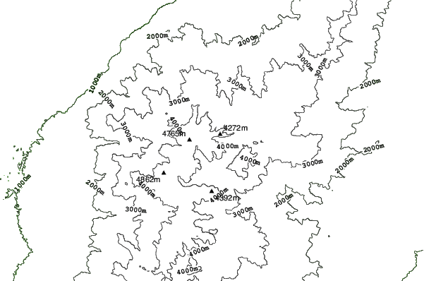
The Ruwenzori is a group of six high glaciated massifs, located in a small remote area between Lake Edward and Lake Albert on the border between Uganda and Zaire. This is part of the African Lake District, west of the Great Rift Valley. The massifs are all topped with several icy summits and are deeply divided by narrow 3,000-foot gorges. The complex is surrounded by a wide belt of boggy foothills, guarding the mountains with an approach through knee-deep mud and practically impassable vegetation. These conditions, coupled with frequent bad weather, saved Ruwenzori from exploration until well after the rest of East Africa had already been explored. In 150 AD, the distinguished geographer Claudius Ptolemy produced an early map of Africa on which a group of mountains just south of the equator were identified as Lunae Montes, or 'Mountains of the Moon'. They were shown to be an important water source, and were subsequently believed to be the source of the Nile. Although Kilimangaro and Kenya have been postulated as the mountains to which Ptolemy referred, it is widely held that the Ruwenzori Mountains are indeed the 'Mountains of the Moon'. The Zaire side is part of the Virunga National Park. Accommodations here are better than on the Uganda side, where mountain huts exist but are mostly run down and unsanitary.
Viajar
- Aeroporto mais próximo:-
- Trem mais próximo:-
- Página de informações da estação:www.skimountaineer.com/ROF/ROF.php?name=Stanley
- Slopeside accom.:-
 -
- -
-
Meios de elevação
- Temporada começa:
- Temporada fecha:
- Lifts:-
 -
-

Último Relatório de NeveVeja o relatório completo da neve
- Emitido:19 Jul
- última queda de neve:—
- Profundidade de neve (topo):–
- Profundidade de neve (base):–
- Pista:—
- Fora de pista:—
Tempo para hoje (3738 m)veja as previsões completas de neve
| manhã | 7 °C | Nivel-F 5000 m | ||
| tarde | 7 °C | Nivel-F 4900 m | ||
| noite | 7 °C | Nivel-F 5050 m |
Estâncias de esqui próximas a Ruwenzori include:
- Afri-Ski 3255km
- Tiffindell 3465km
- Mount Hermon 3709km
- Zaarour 3776km
- Mzaar Ski Resort 3784km
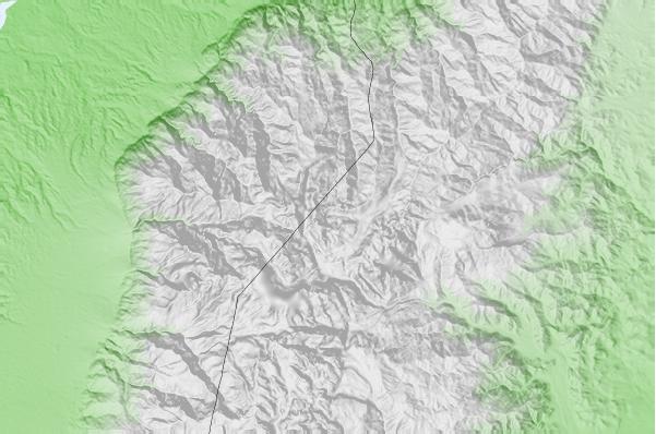
Ruwenzori mapa de localização


(Também veja nosso detalhado Mapa de clima para o Ruwenzori, que irá te dar uma visão global das condições atuais e futuras de precipitação de neve)
Avaliações dos visitantes de Ruwenzori
 Prognósticos das cidades
Próximas a Ruwenzori
- Kasese, Uganda23km
- Fort Portal, Uganda48km
- Beni, Democratic Republic of the Congo52km
- Butembo, Democratic Republic of the Congo78km
- Bunia, Democratic Republic of the Congo124km
 Praias para surf
mais próximas de Ruwenzori
- Mombasa Channel, Kenya1194km
- Watamu Bay, Kenya1199km
- Malindi Bay, Kenya1204km
- Nungwi Reefs, Tanzania1245km
- Jam's Right, Tanzania1307km
 Picos de montanha
mais próximo a Ruwenzori
- Mount Gessi, Congo D R1km
- Mount Emin, Congo D R3km
- Mount Speke, Congo D R6km
- Mount Baker, Uganda8km
- Mount Stanley or Margherita, Congo D R8km
Estâncias de esqui e picos de montanha vizinhos a Ruwenzori
 Nearest