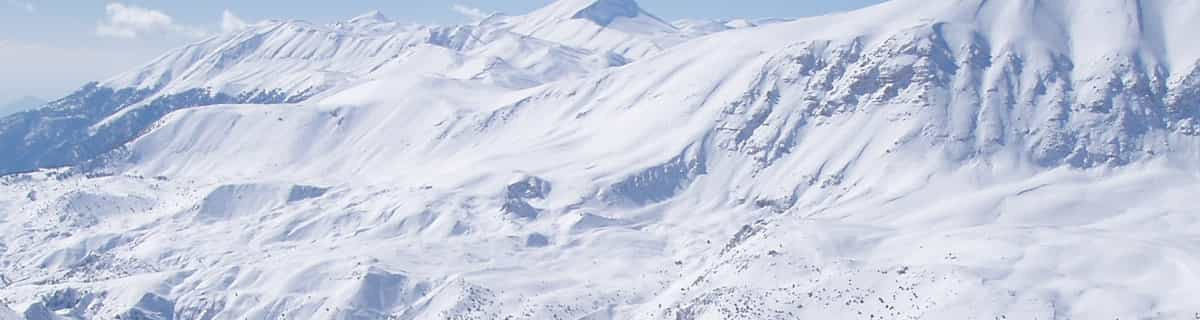


America’s Next Indoor Snow Centre Takes Shape
Construction of a new indoor snow centre for skiers, boarders and tubers appears to be making good progress at Heritage Farm in Wayne County, West Virginia.

Next 3 days weather summary:chuva mod. (total 16.0mm), mais intensa no Domingo à tarde. Muito ameno (máx. 19°C na Segunda à tarde, mín 11°C na Terça à noite). o vento será geralmente fraco. | Dias 4-6 Lungötz Resumo do Tempochuva mod. (total 15.0mm), mais intensa na Qui de manhã. quente (máx. 21°C na Quarta à tarde, mín 9°C na Qui à noite). o vento será geralmente fraco. | ||||||||||||||||
Dom 19 | Segunda 20 | Terça 21 | Quarta 22 | Quinta 23 | Sexta 24 | ||||||||||||
tarde | noite | manhã | tarde | noite | manhã | tarde | noite | manhã | tarde | noite | manhã | tarde | noite | manhã | tarde | noite | |
chuva fraca | aguaceiros | céu limpo | aguaceiros | aguaceiros | parcial/ nublado | aguaceiros | aguaceiros | céu limpo | parcial/ nublado | parcial/ nublado | chuva fraca | Risco Trovoada | aguaceiros | céu limpo | céu limpo | céu limpo | |
km/h | |||||||||||||||||
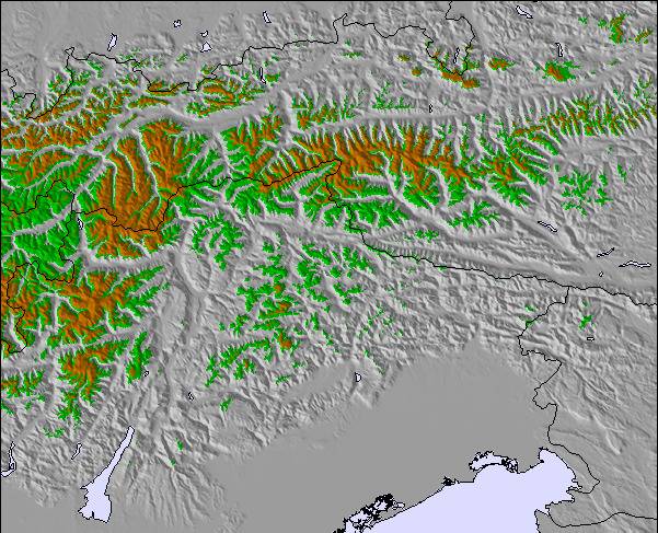
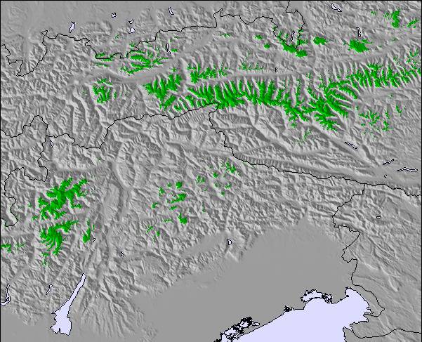
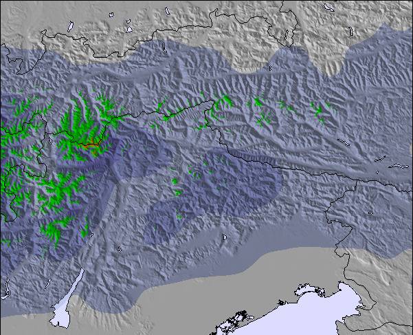
Mapa de neve |  |  |  |  |  |  | |||||||||||
— | — | — | — | — | — | — | — | — | — | — | — | — | — | — | — | — | |
mm | 5 | 1 | — | 3 | 1 | — | 3 | 3 | — | — | — | 4 | 5 | 6 | — | — | — |
max °C | 17 | 16 | 18 | 19 | 17 | 17 | 18 | 14 | 17 | 21 | 17 | 13 | 14 | 13 | 16 | 21 | 17 |
min °C | 15 | 12 | 14 | 19 | 12 | 14 | 17 | 11 | 12 | 20 | 13 | 13 | 13 | 9 | 11 | 19 | 12 |
chill °C | 15 | 12 | 14 | 19 | 12 | 14 | 17 | 11 | 12 | 20 | 13 | 13 | 13 | 9 | 11 | 19 | 12 |
Humid. % | 77 | 92 | 66 | 68 | 86 | 66 | 68 | 86 | 51 | 35 | 75 | 93 | 86 | 90 | 52 | 35 | 77 |
Nível de congel. m | 3350 | 3400 | 3300 | 3350 | 3350 | 3150 | 3000 | 2650 | 3200 | 3300 | 3000 | 2750 | 2850 | 2500 | 2900 | 3200 | 3250 |
— | — | 5:30 | — | — | 5:31 | — | — | 5:31 | — | — | 5:33 | — | — | 5:33 | — | — | |
— | 8:55 | — | — | 8:54 | — | — | 8:53 | — | — | 8:52 | — | — | 8:52 | — | — | 8:51 | |
Vire pro e carve em:
Informações de avalanche: European Avalanche Warning Services (EAWS)
Últimos relatórios de neve perto de Lungötz:
| Profundidade da neve no topo | — |
|---|---|
| Profundidade da neve mais baixa | — |
| Profundidade da queda de neve fresca | — |
| Quando foi a última vez que nevou? | 31 Mar 2026 |
0.0 | Dias de sol com neve pó Neve fresca, principalmente ensolarado, vento fraco. |
|---|---|
0.0 | Dias de neve pó Neve fresca, sol limitado, qualquer vento. |
0.0 | dias de sol Neve média, na maioria das vezes ensolarado, vento fraco. |
As tabelas acima dão a previsão do tempo para Lungötz à altitude específica de 814 m. Nossos sofisticados modelos de tempo permitem-nos obter a previsão de neve para estações no topo, na parte média e na baixa de Lungötz. Para acessar a previsão do tempo para outras elevações, utilize o botão tab acima da tabela. Para uma visão mais ampla do tempo, dê uma olhada em Weather Map" of Austria.
Click here para ler mais informações sobre os níveis de congelamento e de como nós prevemos nossas temperaturas.
Nome do resort é também escrito como Lungotz.
Annaberg (Annaberg-Lungötz) is a quaint village adjoined to the Dachstein West Ski Region which has over 140 km of groomed slopes connecting it to the villages of Russbach & Gosau. The ski area is quite stunning with views of the Hoher Dachstein, at 3004m, and it's glacier and lake below. It has a new ski school and slopes to suit people of all abilities. A family friendly resort which offers some superb off-piste, border parks & 130km of cross-country ski trails. This ski area is a hidden gem to which many visitors return year after year.
Louise Dunn de Austria escreve:
Annaberg (Annaberg-Lungötz) is a quaint village adjoined to the Dachstein West Ski Region which has over 140 km of groomed slopes connecting it to the villages of Russbach & Gosau. The ski area is quite stunning with views of the Hoher Dachstein, at 3004m, and it's glacier and lake below. It has a new ski school and slopes to suit people of all abilities. A family friendly resort which offers some superb off-piste, border parks & 130km of cross-country ski trails. This ski area is a hidden gem to which many visitors return year after year.
Clique aqui para submeter a sua própria avaliação de Lungötz

 Nearest